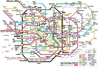
A Transit Map is a topographic map that shows the routes and stations within a public transport system. This particular Transit Map is a Web Trend Map made by Internet Architects in Japan.The different colors in this map represent different site categories.
Matt and his maps
Tuesday, July 24, 2012
Pictorial Maps
A Pictorial Map is a map that depicts an area in more of an artistic fashion. This maps typically are shown above at an oblique angle. This particular map is a pictorial map of Boston, Massachusetts.
Dymaxion map
A Dymaxion map is a map projection onto the surface of a icosahedron. An Icosahedron is a polyhedron with 20 equilateral triangles. This map makes the world look like one island as opposed to multiple continents.
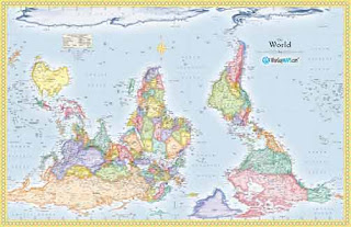
Reversed Map
Monday, July 23, 2012
DLG
DLG mapping is a cartographic map represented in digital vector form that is distributed by the U.S. Geological Survey. Digital Line Graphs are formatted to work with GIS technology and mapping applications. This particular map is of Athens Georgia.
DRG
Digital raster graphic (DRG) is a digital image resulting from scanning a paper of a topographic map for use on a computer. DRG maps are primarily used with GIS technology. This particular map shows the topography of Michigan.
Isopleths
An Isopleth map uses lines joining points of an equal value to show variations in that value. This particular map portrays wind velocity by month around the Columbia River. This Map is considered an Isopleth because it has lines joining the points of equal value though out the months.
Subscribe to:
Comments (Atom)


